Sir,
It is with reference to media reports on ‘Chitral-Shikashim Highway’ which reminds me of another report in a Peshawar-based daily in December, 2004. Responding to the said report this scribe had given brief account of merits and demerits of the historical ancient route of the people of North and North East Asia, the Boroghil Pass via the main Chitral valley as part of the ancient Silk Road and Garumchashma route leading to northern part of Afghanistan. I had requested the Highway authorities to carry out a survey of both the sites during Feb-April when all the valleys were clad in snow and obstructed by snow avalanches blocking even pedestrians. During the winter months one can easily find out the dangerous and obstructive areas and the site feasible for construction of a high way which will be serviceable round the year.
Again, the same newspaper published a news item on Dec:19, 2004 in which it was reported that the then Minister for Water and Power Mr. Liaqat Ali Jatoi had directed NESPAK to finalize feasibility report for establishing road link between Pakistan and Tajekistan at the earliest and submit to the authorities for approval. The report further gave some detail of the proposed site starting from Gilgit, crossing Shandur and Mastuj valley it was to cross Broghil Pass via Yarkhun valley. Had the survey been carried out by the company as referred to by Mr. Inayatullah Aseer been feasible, NESPAK would not have been directed for feasibility report of another site as mentioned above.
My humble request to each and every Chitrali brother with knowledge of the ancient history and geographical conditions of the regions north and south of the Hindukush ranges is that the issue of Chitral-Tajekistan Road may not be politicized. We should not advocate for a certain and certain site, rather we should provide guidance to the concerned authorities on the basis of historical proofs.
Exact and accurate information provided to the concerned authorities shall enable them to select the most suitable site for this important high way to be proved more beneficial not only for Chitral and our country but for all the stake holders as well.
We give priority to Chitral-Broghil site for the anticipated highway on the following grounds:
1- That road will cross all through Pakistani territory (except a few kilometers
of Wakhan strip), ensuring complete safety and security of commuters.
2- There is cost benefit because a 25 feet kacha road has already been constructed up to Wedinkot, Broghil.
3- The project will be completed within very short period expending approximately 50% less of the estimated cost of the project, because no solid rocks and mountains come in the way and construction of no extra bridges over the rivers or streams involve.
4- It will easily link with the Qaraqurum High way through Shandur Pass at Mastuj and Darkot Pass at Boroghel providing alternate passage in case of blockage of any one of these roads.
5- It will prove all-weather road as there is no apprehension of blockade during winters due to snow avalanches and sliding.
6- Last but not least, the historical records must be kept in view and the fact should be accepted that ‘history repeats it self’ and if we go against it, we shall be doing a big blunder and that our future generation will not forgive us. Leaving aside all other references I am quoting, I.D. Scot, ICS, Late APO, Chitral in the NOTES ON CHITRAL, published by Government of India Press, Simla, 1937, at page, 2, “The more usual route, however, is over the Boroghil Pass, across Wakhan, and so to the Yarkand valley. Until recently these routes, especially the Boroghil were extensively used by caravans of Turkistan traders on their way to India. For various reasons this trade has at present practically ceased. These have been trade routes from time immemorial and were much used by Chinese pilgrims in the early centuries AD on their way to the Buddhist shrines of India”.
In the following paragraph, he mentions the passes leading to north east of Afghanistan and refers to Durah Pass as, “ The most important pass leading out of Chitral on the north west is the Durah, an easy pass of 14,000 feet leading to Mazar-i-Sharif, the capital of the Afghan province of Badakhshan, to Khanabad, and on to Balkh and Afghan Turkistan. There used to be a very considerable trade over the Durah Pass chiefly in salt, tea, sugar and wool, from which Chitral extracted profit from toll; at present, however, an average of only about 40 traders cross every week during the summer months”
The above description of both the passes is self explanatory to determine the most feasible site for the anticipated Chitral-Tajekistan High Way.
Sher Wali Khan Aseer,
Abbottabad
Subscribe to:
Post Comments (Atom)
Awesome and rugged

Beauty of Chitral
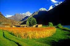
Kishmanja, a beautiful village in Yarkhun valley
Lush green
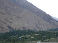
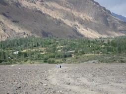
DIZG: threatened by floods
The legendary village of Ayun in Chitral

On way to Bumburet
Dizg, Yarkhun
About Me

- Zar Alam Khan Razakhel
- Village Dizg, Yarkhun valley, Chitral, Pakistan
- I blog at http://chitraltoday.net (ChitralToday) about Chitral, its people, culture, traditions and issues. I have been writing about Chitral since 2000. Chitral is a scenic valley in the extreme north-west of Pakistan.
No comments:
Post a Comment